
Open Source Alternatives to GeoPhoto
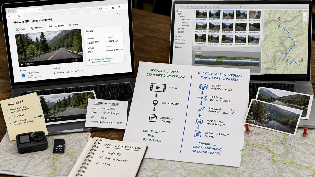
GPS Coordinates from Video is a browser-based alternative for users who need this focused result without installing a proprietary desktop app or entering a larger hosted workflow.
This research compares that workflow with GeoPhoto while keeping the outbound source link at the bottom after the analysis.
Why GPS Coordinates from Video fits
GPS Coordinates from Video works when the user has one clip and needs to read existing coordinates without installing a map-library application.
What GeoPhoto offers
GeoPhoto is a Windows and Mac app for viewing photos and videos on a map, correcting locations, importing GPX or KML tracks, and unlocking larger library workflows with Pro features.
Open alternative signals
Source and openness
GPS Coordinates from VideoBrowser-based and open-standard-focused without a public source claim.
GeoPhotoDesktop app with optional Pro features.
Deployment
GPS Coordinates from VideoNo install; one video at a time.
GeoPhotoInstalled Windows and Mac app for folders and libraries.
Pricing shape
GPS Coordinates from VideoOne shared TextFaker lifetime unlock after free successful uses.
GeoPhotoFree to try with Pro features for larger libraries and geotagging.
Data control
GPS Coordinates from VideoDesigned for local browser reading of a selected clip.
GeoPhotoLocal desktop workflow suited to larger media collections.
Decision guide
Use GPS Coordinates from Video when a user needs a quick browser check of one original video.
Use GeoPhoto when the user wants to browse a media library on a map, add or correct GPS positions, or work with GPX and KML tracks.
Side-by-side open source alternative comparison
| Decision point | GPS Coordinates from Video | GeoPhoto | Takeaway |
|---|---|---|---|
| Alternative fit | Our workflowSingle-video coordinate inspection. | Proprietary workflowPhoto and video map library with editing. | Use our tool when a full map app is unnecessary. |
| Source model | Our workflowOpen standards and browser APIs. | Proprietary workflowProprietary desktop application. | This is a lightweight web alternative, not a full desktop clone. |
| Setup and deployment | Our workflowOpen page and choose one video. | Proprietary workflowInstall an app and work with folders or libraries. | Setup cost is the main advantage for our tool. |
| Feature parity | Our workflowRead existing GPS metadata and map it. | Proprietary workflowView media on maps, correct GPS, add locations, import tracks, and export location data. | GeoPhoto wins for collection and editing workflows. |
| Editing and export parity | Our workflowRead-only with copy/map actions. | Proprietary workflowGeotag editing and GPX/KML track workflows. | Do not use our tool when missing GPS must be added. |
| Migration path | Our workflowUse for ad hoc checks before sharing or mapping a single clip. | Proprietary workflowKeep for media-library mapping and geotagging. | The tools serve different job sizes. |
Detailed research
Open-Source Alternative Fit
GeoPhoto is much broader than a coordinate viewer. GPS Coordinates from Video fits the open-alternative intent when users only want to inspect one clip without installing a desktop application.
The page should acknowledge that GeoPhoto is stronger when the user has a library or needs to create geotags.
Feature Parity and Limits
Our tool can read existing GPS coordinates when they are stored in the video metadata. It should not promise to write coordinates, import tracks, or build media libraries.
GeoPhoto's track and Pro workflows are legitimate reasons to keep the proprietary tool.
Data, Setup, and Pricing
A browser check is faster for one clip. A desktop app can be more appropriate for a private local library because it is built for folders, map browsing, and editing.
Practical Migration Guidance
Use GPS Coordinates from Video as a quick inspection layer. Use GeoPhoto when the work becomes collection-scale or when GPS data must be added, corrected, or matched from tracks.
Research notes
- GeoPhoto's official page states that photos and videos need GPS location data to appear on the map.
- It supports adding or correcting GPS positions and track-assisted geotagging, which our tool does not do.
- Our tool is a lightweight inspection alternative, not a replacement for a desktop map library.
Official source
The proprietary product link is included once here for source checking after the alternative analysis.
Official GeoPhoto source